
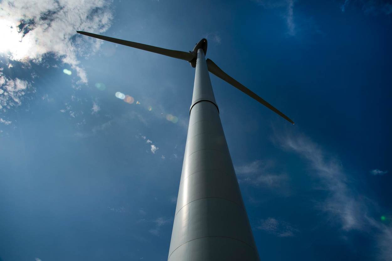
Innovations in the DOWA project
Within the DOWA project, the project partners aim was to produce the best possible 10-year wind climatology for the wind energy sector. To do so, not only state-of-the-art knowledge, models and measurements are used, but the project is innovative in many ways. The main innovations are:
- The new models and methodology to make the DOWA
- The way to nest Large Eddy Simulations in mesoscale weather model HARMONIE
- The way to include wind farm (cluster) wake effects in mesoscale weather model HARMONIE
- Low level jets and their impact on wind turbine performance
- Wind turbine parametrization in GRASP
- Scanning LiDAR measurements to assess high altitude wind
1. New models and methodology to make the DOWA
Both the KNW and DOWA wind atlases are based on global re-analyses that were “downscaled” using the mesoscale weather model HARMONIE-AROME (Official name. Referred to as HARMONIE on this website). The re-analysis model used to make the KNW-atlas is ERA-Interim and for the DOWA its successor ERA5 (Dataset citable as: Copernicus Climate Change Service (C3S) (2017): ERA5: Fifth generation of ECMWF atmospheric reanalyses of the global climate. Copernicus Climate Change Service Climate Data Store (CDS), date of citation) was used. For the downscaling of the DOWA, a later version of HARMONIE was used: Cycle 40h1.2.tg2 (instead of Cycle 37h1.1). This HARMONIE version provided enhanced turbulence modelling, and therefore resulted in a more accurate representation of the wind field and e.g. verify better against ASCAT satellite wind speed measurements.
ERA5 is the fifth generation atmospheric re-analyses of the global climate made available by ECMWF. ERA5 will (once completely available) eventually replace ERA-Interim, which was the global re-analysis used to make the KNW-atlas. In re-analysis, 3D wind fields are generated based on available meteorological measurements and the governing laws of physics. The main differences between ERA-Interim and ERA5 are:
- ERA5 will eventually be available from 1950-now (ERA-Interim Jan 1979 - Aug 2019)
- ERA5-data available every hour (ERA-Interim 6 hourly)
- ERA5 horizontal grid spacing of 31 km (ERA-Interim 79 km)
- ERA5 vertical grid spacing 137 levels up to about 80 km (ERA-Interim 60 levels)
- ERA5 has 3 hourly uncertainty info (grid 62 km) and extra parameters including 100 m wind
- ERA5 used a newer model version of the ECMWF-model (see Confluence for the complete list)
For the DOWA, not only new model versions were used, but also the methodology was improved:
- Assimilation of measurements: for the KNW-atlas, HARMONIE was used only as a downscaling-tool without feeding the model with additional measurements (the only measurements included were the ones that were used to make the ERA-Interim reanalysis). For the DOWA, HARMONIE’s full potential as a weather forecast model was leveraged by assimilating additional (not used in ERA5) – both conventional and innovative – measurements. The 3DVAR assimilation technique was used to assimilate measurements every 3 hours at the beginning of each HARMONIE forecast cycle (see explanation below). Innovative measurements included high-resolution satellite surface wind fields (ASCAT) and aircraft wind profile measurements (MODE-S EHS). As a result of using this data-assimilated HARMONIE, the quality of the time series and the representation of the diurnal cycle improved. More info on data-assimilation methods for convective-scale weather prediction can be found in the article by Gustafsson et al, 2018.
- Cold start: for the KNW-atlas, we started every 6 hours with the ERA-Interim re-analysis and used the +1h up to and including +6h forecast of HARMONIE (no data assimilation) to make the atlas. Every 6 hours we started with a new ERA-Interim reanalysis (cold start). There are no cold starts in the DOWA-runs, except at the very beginning of each parallel stream (Stream A (2010-2012), stream B (2013-2014), stream C (2008-2009) and stream D (2015-2017) were run simultaneously to speed up calculations (it takes about 1 month to calculate 4 months) and then glued). DOWA is made with +1h, +2h and +3h forecasts of HARMONIE within a domain of 800 by 800 grid points around KNMI meteomast Cabauw, which is part of the Cesar-observatory. Every hour the boundaries of the domain (North, South, East and West at all model levels) are fed with ERA5-reanalyses data. We initialize every 3 hour forecast cycle with the latest HARMONIE-forecast of the previous cycle (no cold start with ERA5) and data-assimilation of measurements.
| KNMI North Sea Wind (KNW) atlas | Dutch Offshore Wind Atlas (DOWA) | |
|---|---|---|
| Timespan |
1-1-1979 until 31-8-2019 18 UTC (40+ years) |
1-1-2008 until 31-12-2018 (11 years) |
| Variability of the North Sea wind climate | Captures the variability of the North Sea wind climate (40 years long enough) | Does not capture the variability of the North Sea wind climate (10 years not long enough) |
| Used models | Based on re-analysis ERA-Interim and mesoscale weather model HARMONIE Version 37h1.1 (1979-2013) and Version 37h1.2.bugfix (2013-2019), the latter tested and adapted to guarantee a homogeneous dataset. | Based on re-analysis ERA5 (follow-up of ERA-Interim with higher spatial and temporal resolution) and mesoscale weather model HARMONIE-AROME Version 40h1.2.tg2 (improved wind information because turbulence is better modelled) |
| Method | HARMONIE used as downscaling-tool only (data-assimilation of measurements in ERA-Interim only) | Additional measurements assimilated in HARMONIE (ASCAT-satellite surface wind measurements and MODE-S-EHS aircraft wind profile measurements) |
| Climatological information height | Climatological information up to and including a height of to 200 m | Climatological information up to and including a height of 600 m |
| LES-downscaling | Lacks the information required for further LES-downscaling | Information required for further LES-downscaling included |
| Cold starts | Cold starts: limited quality of hourly correlation with measurements (e.g. diurnal cycle) | No cold starts: better hourly correlation with measurementsand representation of the diurnal cycle |
| Wind shear correction | Uniform wind shear correction applied |
No wind shear correction required |
2. Nesting LES in HARMONIE
KNMI uses a global (for the whole world) weather model (ECMWF: grid spacing roughly 9 km) and a regional mesoscale weather model (HARMONIE for a part of Europe: grid spacing 2.5 km) to make weather forecasts (see figure below). The technique for nesting the regional model HARMONIE into the coarser global model ECMWF is fairly standard, but it is unknown if it is possible to nest LES-models (with an even higher resolution) in HARMONIE. Innovative strategies will be explored to see if this can be made possible. If so, Whiffle can using mesoscale model HARMONIE instead of global model ECMWF as a hosting model for their LES-simulations and this is expected to improve their fine-scale weather forecast and weather simulations. LES-simulations are very computationally demanding, but Whiffle has succeeded in speeding up the LES simulations by using large parallel supercomputing platforms and Graphical Processing Units (GPU) software. More information on GPU-based Large Eddie Simulations.
Whiffle starts with the ECMWF global weather forecast and uses GRASP (the GPU-version of the DALES-model that was developed by TUDelft, KNMI and WUR) to make their fine-scale weather forecast and weather simulations. In the DOWA-project Whiffle and KNMI have worked on making it possible to run GRASP with HARMONIE weather forecasts as input. Two different methods were tested, both having their advantages and disadvantages, depending on the size of the LES domain.
Nudging method
HARMONIE is nested in the global ECMWF model by nudging HARMONIE at the lateral boundaries towards the atmospheric state of the ECMWF model. This way, weather processes acting on scales larger than the domain size of HARMONIE are introduced into the limited area domain. In a similar way, LES can be nested in HARMONIE by nudging LES at the lateral boundaries towards HARMONIE. The main advantage of this approach is that certain weather events, like for example frontal passages, are transferred in a realistic way from HARMONIE to LES. However, as LES explicitly resolves turbulence and HARMONIE not, the air near the lateral boundaries needs some time to adjust from the non-turbulent state in HARMONIE to the turbulent state in LES. This requires a sufficiently large LES domain (of the order of 50 km), which makes this approach computationally demanding.
Large scale or dynamic tendency method
As an alternative to the nudging method, information about the weather on scales larger than the LES domain can also be provided to the LES model in the form of large-scale dynamic tendencies. These large-scale dynamic tendencies are the mean tendencies of (for example) the advection of momentum (wind), temperature and moisture acting on the LES domain, and are added to the LES model as a horizontally homogeneous forcing (i.e., only varying with height). This method was pioneered at KNMI and the TUD, and is currently used by Whiffle, with the large-scale tendencies estimated from 3-hourly routine output of the ECMWF model. Given the short-term variability of the weather, the use of 3-hourly (instantaneous) forcings might mean that details on shorter time scales are lost. The innovative aspect of the DOWA project is to output the dynamic tendencies directly from HARMONIE, at a high temporal frequency, and with the tendencies accumulated in time. This should assure that the full dynamic tendencies are transferred from HARMONIE to LES.
3. Wind farm (cluster) wake effects in HARMONIE
As more and more wind farms are being built on the North Sea, meso-scale models can no longer ignore their presence. HARMONIE on a 2.5 grid spacing can e.g. resolve processes on a 10-15 km scale and the Borssele wind farm area is of the same scale. The DOWA-project will therefore also investigate ways to account for wake effects from multiple wind farm clusters in meso-scale model HARMONIE itself. The work includes:
1. Getting the windfarm information required for the wake parametrization:
- The number and location of wind turbines within the farm. From this, the number of turbines within the model grid boxes over sea covering the area of the wind farms will be determined.
- The type of wind turbine used. It is assumed that all wind turbines within a farm are of the same type. From the turbine type, the following information for the wake parametrization will be derived: turbine height, the diameter of the rotating blades, and a lookup table for the power and thrust coefficients as function of wind speed. If the turbine type is not known, then default values for these quantities will be adopted.
2. Coding the wind farm parametrisation. Per affected grid-point: a momentum sink in the form of a drag relation is imposed on the mean flow for the fraction of the grid box area and the model levels which are affected by wind turbines (1) and kinetic energy is transferred into wind energy and turbulent kinetic energy (2). The method used is conform method Anna C. Fitch, 2012, who did this for WRF.
3. “Sanity check” where the implementation of the wind farm wake parametrisation in HARMONIE is checked against WRF with the same wind farm wake parametrisation for a historical case (in close cooperation with TU Delft).
4. Doing a re-run of DOWA with wind farm wake parametrisation of the Belgian wind farms Thornton Bank phase I (fully commissioned since 10-5-2009), Belwind (fully commissioned since 9-12-2010), Thornton Bank phase II (fully commissioned since 31-1-2013), Thornton Bank phase III (fully commissioned since 18-9-2013) and Northwind (fully commissioned since 30-6-2014) included, for the period from June 2015 until February 2016 when floating LiDAR measurements were done in the Borssele wind farm zone (BWFZ-measurements). This DOWA-re-run will be compared to WRF with a similar wind farm wake parametrisation (in close cooperation with TU Delft), Whiffle’s LES-simulations and the floating LiDAR measurements in the BWFZ.
4. Low level jets and their impact on wind turbine performance
Analyses were performed on offshore wind measurements to get a more detailed understanding of the North Sea wind climate. Of particular interest was the spatio-temporal behaviour of the offshore low-level jet (LLJ): an anomalous wind event that can have a significantly effect on both wind turbine power performance and loads. Studies of the offshore LLJ using the measurements of meteomast IJmuiden have been done before, but what is new about the work done in the DOWA project is, is that other LiDAR measurements of the wind at higher levels were included, such as the LiDAR measurements at K13, Europlatform and Lichteiland Goeree and the floating LiDAR measurements at Borssele, Hollandse Kust Noord and Zuid wind farm zones. Results of this study of the spatio-temporal can be found in publications on this website. What is also new is that the effect of offshore LLJ’s on turbine performance and loading will be determined, making use of our more detailed knowledge on offshore LLJ’s and a LES simulations provided by Whiffle.
5. Wind turbine parameterization in GRASP
A parameterization that includes individual wind turbines in the LES model GRASP has been developed and implemented. With this innovation, a unique atmospheric model that captures the most important atmospheric effects for wind energy applications has been created. The model is able to produce turbulence resolving weather forecasts, both in for short-term forecasts up to several days ahead and for long-term wind climatology runs covering several years of historical weather. The expected benefits of this approach are that the interaction between wind farm wake effects, atmospheric stability and turbulence is fully taken into account. Effectively, this results in a weather model, a wake model and a power model in a unified model.
6. Scanning LiDAR measurements to assess high altitude wind
ECN part of TNO purchased a WindCube 200S long range scanning LiDAR in autumn 2017. Within the framework of the DOWA project the system was installed at the dunes of the Petten premises, particularly to assess the high altitude winds. For the period November and December 2017 wind measurements were done with the so-called DBS mode (Doppler Beam Swing) for altitudes ranging from 100m to 7050m with intervals of 50m. By applying appropriate data quality filtering decent wind speed and wind direction measurements are obtained up to 2000m. From these data an average wind shear profile was obtained.
The system was installed in complex terrain with winds from sea from the West, with winds from land from the East and with winds across the dune line from the North and the South. Obviously, these various winds have different effects on the profile, so averaged profiles per wind direction sectors were made.
The obtained results are compared to the KNW data for the indicated area. It is clear that a fair comparison is hard to achieve, because the scanning LiDAR uses volume averaging to obtain wind speed and direction and even more the KNW generates an average output over an area of 2.5 by 2.5 km. Both facts are quite significant in such a complex area. Nevertheless, we believe that the comparison is valuable for both the scanning LiDAR measurements and the KNW data, because measurements at such a high altitude are very scarce.