
Difference between DOWA and KNW
Valuable addition to the KNW-atlas
The KNW-atlas contains climatological and hourly undisturbed wind data (without wind turbine wake effects) based on more than 40 years (1979-2019) of re-analyses data. The wind speeds in the atlas have a climatological accuracy comparable to that of wind measurements. So if you are interested in long-term statistical values such as averages and extremes, the KNW-atlas is hard to beat. However, due to the applied method to create the KNW-atlas, the hourly correlation with measurements (e.g. daily cycle) is rather poor.
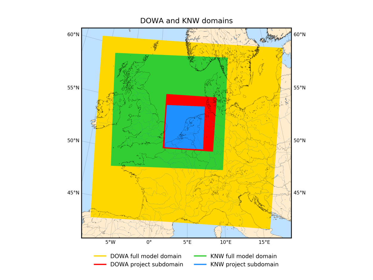
Also, the KNW-atlas lacks information above 200 meter height and information that enables further downscaling with Large Eddy Simulation (LES) methods. The Dutch Offshore Wind Atlas (DOWA) presented on this website is a 10 year climatology (2008-2017) with a better hourly correlation than the KNW-atlas, information up to 600 m heights and the option to downscale the information in DOWA from hourly to less than 60 seconds and from 2.5 km to less than 100 m horizontally. Also the domain is larger than that of the KNW-atlas, including the areas where the German wind farms are (being) built and planned (see figure 1).
| KNMI North Sea Wind (KNW) atlas | Dutch Offshore Wind Atlas (DOWA) | |
|---|---|---|
| Timespan | 1-1-1979 until 31-8-2019 18 UTC (40+ years) | 1-1-2008 until 31-12-2018 (11 years) |
| Variability of the North Sea wind climate | Captures the variability of the North Sea wind climate (40 years long enough) | Does not capture the variability of the North Sea wind climate (10 years not long enough) |
| Used models | Based on re-analysis ERA-Interim and mesoscale weather model HARMONIE Version 37h1.1 (1979-2013) and Version 37h1.2.bugfix (2013-2019), the latter tested and adapted to guarantee a homogeneous dataset. | Based on re-analysis ERA5 (follow-up of ERA-Interim with higher spatial and temporal resolution) and mesoscale weather model HARMONIE-AROME Version 40h1.2.tg2 (improved wind information because turbulence is better modelled) |
| Method | HARMONIE used as downscaling-tool only (data-assimilation of measurements in ERA-Interim only) | Additional measurements assimilated in HARMONIE (ASCAT-satellite surface wind measurements and MODE-S-EHS aircraft wind profile measurements) |
| Climatological information height | Climatological information up to and including a height of 200 m | Climatological information up to and including a height of 600 m |
| LES-downscaling | Lacks the information required for further LES-downscaling | Information required for further LES-downscaling included |
| Cold starts | Cold starts: limited quality of hourly correlation with measurements (e.g. diurnal cycle) | No cold starts: better hourly correlation with measurements and representation of the diurnal cycle |
| Wind shear correction | Uniform wind shear correction applied |
No wind shear correction required |